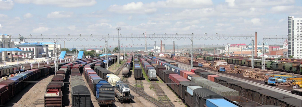
The Sino-Russian-Mongolian border triangle is located in the upper basin of the Argun River. The Argun, a wide headwater tributary of the Amur, marks the oldest boundary section between Russia and China. Although the line of delimitation has not shifted significantly since 1689, it has nevertheless not been acknowledged as a “hard” boundary until recently. The topographical character is twofold: the southern tips of the Russian taiga forest belt blanket the north, and the Mongolian plains extend into the south. From the Hailar valley northwards, a dry, grass-covered steppe covers both banks of the Argun. To its north is located the triangular district of the Three Rivers. The broad valleys of this district are its most fertile areas. For almost two centuries there were no significant settlements in this vast and yet not totally unpopulated territory. The region remained largely isolated until the late nineteenth century. The construction of the Chinese Eastern Railroad, the last leg of the Trans-Siberian railroad, finally linked Vladivostok and Chita through Manchuria in 1903, thereby stimulating the establishment of new settlements. Of these, the border town of Manzhouli was to become the most important. The railroad transformed the border region from a remote no-man’s-land into a center of cross-border economic exchange. Manzhouli soon became the major economic hub for Sino-Russian commerce. On the other side of the border, the 86 Railroad Siding gradually developed into a small border station called Otpor, later renamed Zabaikalsk when it was upgraded to a proper town. These twin communities and their pastoral surroundings make for an excellent prism through which to view the phenomena of border making and border breaking.
Research
The aim of this project was to offer a more comprehensive insight into the emergence and evolution of the Sino-Russian border. Central issues discussed in this project were the process of border formation as both result and negation of state policies, and the impact of nascent political borders on the people who roamed the vicinity. This project recovered the flexibility of the strategies and practices pursued by ordinary people in coping with the border, and sought to identify modes both of border-making and of border-breaking. Therefore, some of the main queries at hand were: what were the forces that drove the formation of the border, and how did they bring about changes to the outer limits of Russia and China, from a mere line on the map drawn between two “empires” to a border between two “nation-states?” What role did local communities play in the process of nationalizing the peripheries? What traits might we ascribe to the typical border dweller, and how did these change over time?
This work was based on a wide-ranging body of sources from Russian and Chinese archives and from libraries around the globe. It was supplemented by extended interviews with locals from both sides of the fence: with Chinese, with Russians, and with descendants of mixed-marriage parents. Interviewees had worked as railroad shunters, clerks, farmers, and teachers. Their commonplace professions, and their otherwise typical biographies, make their stories indispensable to the task of deepening our insight into everyday social practices in the borderland. Archival records can provide the foundation for a source-based narrative. Yet they rarely touch on informal issues, such as contacts between Chinese and Soviet railroad employees during the time of the Sino-Soviet rift, or border guards’ ways of spending leisure time.


